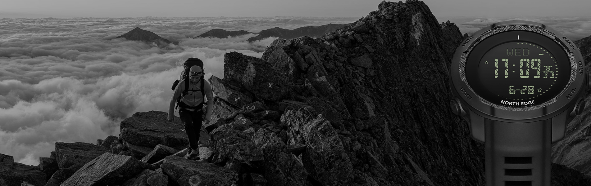
what are you looking for?
ALTIMETER
Measuring altitudes based on changes in atmospheric pressure
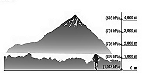
The altimeter determines the altitude at your current location based on accumulated atmospheric pressure changes measured by the pressure sensor. Setting the altimeter at a location where you know the precise altitude before starting your ascent enables it to take even more precise altitude measurements.
Sea level measurement
Setting the altimeter at a location where you know the precise altitude enables you to determine the elevation of your current position with respect to sea level. If you come across a marker indicating 400 meters above sea level while hiking or climbing, for example, simply set the altimeter at 400 meters. This enables you to obtain more accurate readings with respect to sea.
BAROMETER
Forecasting the weather based on the atmospheric pressure tendency
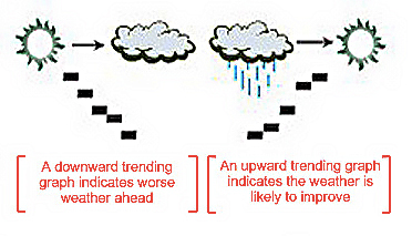
A graphic display of atmospheric pressure readings taken at regular intervals reveals pressure trends at a glance. When the pressure is rising, the weather is likely to improve; when it's falling, there 's ususally worse weather ahead.This feature can remind you to take your swimming suit along, or alert you to approaching trouble.
------------------------
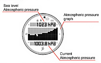
Atmospheric pressure tendency graph / indicator
The barometer measures the atmospheric pressure every two hours automatically and displays the recent atmospheric pressure tendency and the current pressure praphically. Level when you take subsequent measurements after moving on.
COMPASS
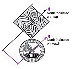
Aligning a map with the surrounding terrain
If you determine magnetic north with the direction measurement function and place a map beside your watch, you can align the map with the surrounding geography.
Magnetic declination correction
You can change the direction measurement standard from "magnetic north" to "true north" by inputting the magnetic declination data indicated on a topographical map to correct the direction. Level when you take subsequent measurements after moving on.
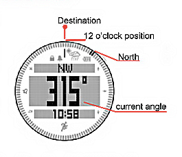
Bearing Memory [ select models only ]
The Bearing Memory memorizes directions detected by the direction measurement function and displays them continuously in graphic format. You can travel straight toward your destination by following a course determined with the memorized direction displayed steadily in the 12 o'clock position on your watch face. This capability also comes in handy when visibility is low due to such factors are trees or fog.
------------------------
THEROMETER
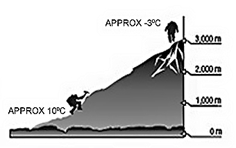
Predicting your destination temperature based on the temperature at your current location
The temperature generally decreases by approximately 6.5°C with every increase in altitude of 1,000 meters, or 3.6°F with every increase of 1,000 feet. If the temperature at 1,000 meters is 10 ℃, therefore, the temperature at 3,000 meters will probably be about -3℃.
-----------------------
DIVE MODE
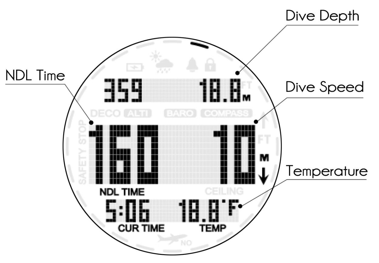
No Decompression Dlgorithm for Dive
The watch use the Bühlmann ZH-L16C model. The Bühlmann ZH-L16C is a commonly used diving algorithm for calculating the dive time and required decompression stops during ascent for divers. Based on the Bühlmann ZH-L16 algorithm, which incorporates 16 tissue/blood compartment segments, this model calculates the maximum safe bottom time for divers without the need for decompression stops, taking into account depth, time spent, and the rate of change in depth.
------------------------


 Room# 409,No.14 Liushan Middle Road,Haicang District, Xiamen, Fujian, China
 TEL: +86 13859906061
 Email: sales01@northedgewatch.com
Email: lily@northedgewatch.com
Email: sales01@northedgewatch.com
Email: lily@northedgewatch.com